Land Speak of the John Muir Trail
Behind the scenes
Introduction to the John Muir Trail
In 2017 Jason Koster and fellow hiker set their sights on backpacking the John Muir Trail.
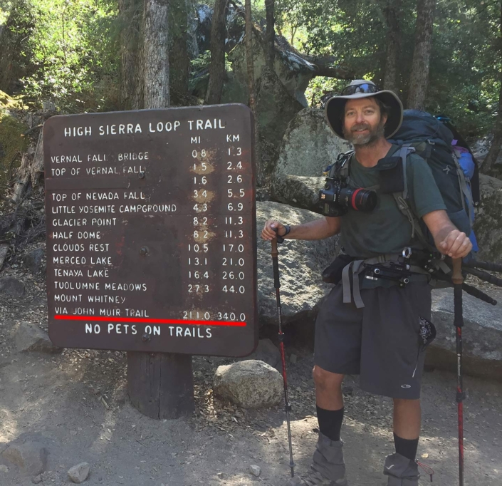
The John Muir Trail (JMT) is a portion of the Pacific Crest Trail in the Sierra Nevada mountains of California and is considered a strenuous 211 mile hike spanning the 14,505ft peak of Mt. Whitney to Yosemite National Park.
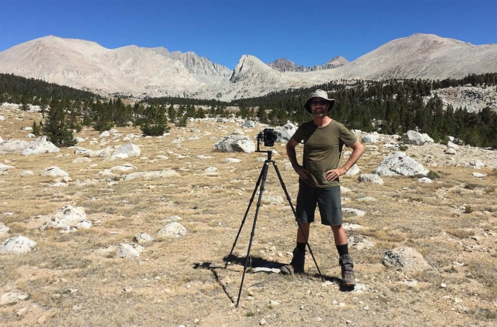
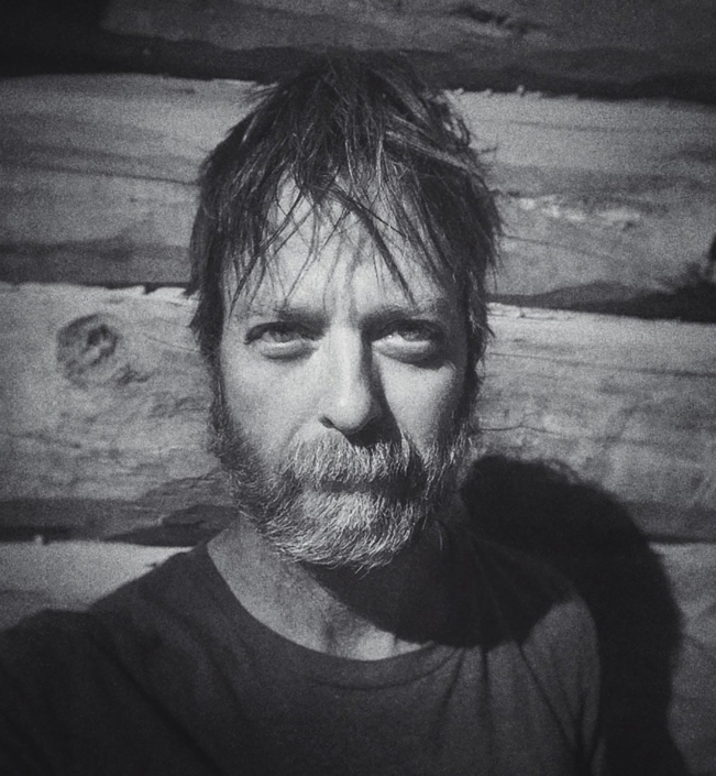
Jason Koster fine art photography
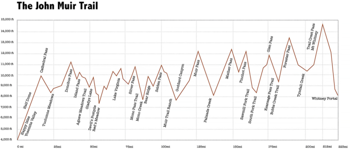
Elevation map of the John Muir Trail.
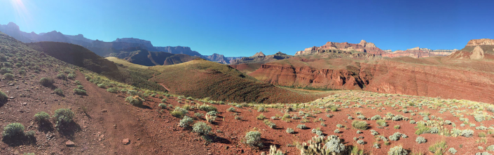
Part of what makes the JMT so strenuous is the elevation gain and loss which is calculated to equal hiking the Grand Canyon – rim to rim to rim – six times!
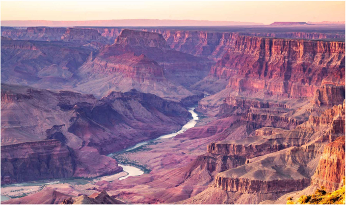
The Grand Canyon
Planning for the John Muir Trail
There is a long waiting list to get a permit to enter the JMT. Koster filed many requests before being granted a permit to hike northbound in September of 2018. For the sake of crowd control the permit did not include entering the JMT from the popular Whitney Portal which is at the east base of Mt. Whitney. Koster’s plan B was to start south from Horseshoe Meadows which is west of Lone Pine, CA. After 30 miles of hiking, on the fourth morning Koster would reach the summit of Mt. Whitney – the official start of the JMT.
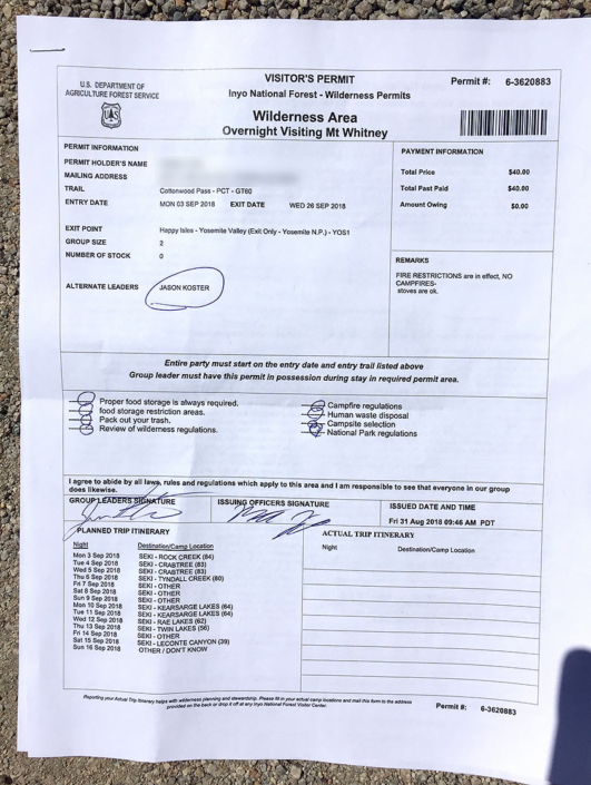
Immediately after picking up John Muir Trail permit Koster steps outside the Ranger station sends photo to co-hiker to say, Game on!!
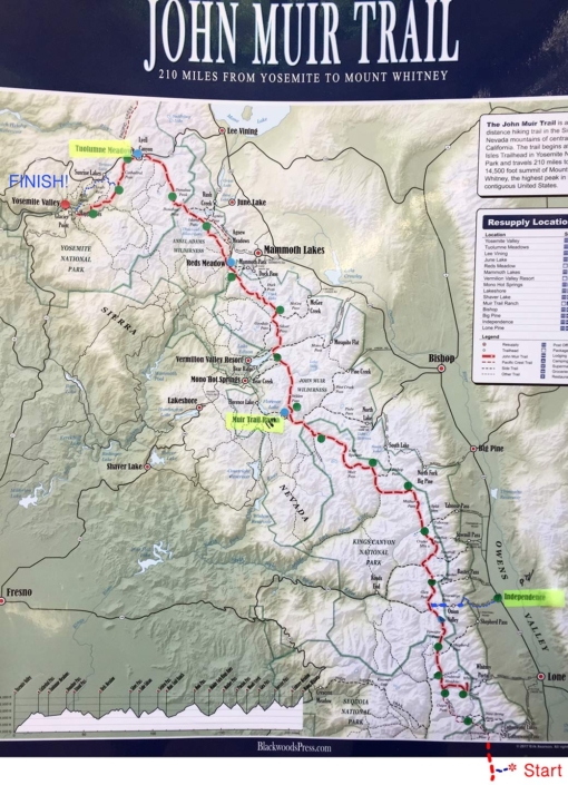
Souvenir map of the John Muir Trail showing Koster’s starting point off the map. Dots indicate potential end of day campsites. The highlighted areas- Independence, Muir Trail Ranch and Tuolumne Meadows are resupply locations.
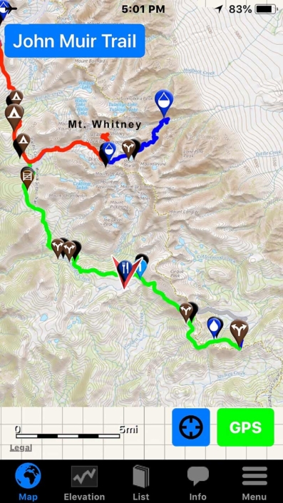
Screen shot of the John Muir Trail map on Koster’s phone. The green line marks the two and a half day hike to reach the John Muir Trail. The red line is the John Muir Trail. The portion of the red line that goes to the right leads up Mt Whitney. The blue line is the trail from the Whitney Portal to join the JMT.
Preparation for the John Muir Trail
Koster: The first thing we noticed about this hike was the fact that Mt. Whitney is 14,505ft high. You hear stories about people ascending Whitney too fast, getting altitude sickness and having to be rushed to the hospital -their entire trip ruined. This was enough of a concern to make my co-hiker and I have the conversation: what if one of us goes down? What is the other expected to do? We decided they had to take extra pictures and not get lost. (laughs) When my friend suggested we spend an entire day acclimating at Horseshoe Meadows, which is at 9,000ft, I didn’t like tacking on an extra day to our trip but, it seemed like a smart strategy. I looked into altitude conditioning but, apparently the conditioning doesn’t last long enough to help us by the time we arrive anywhere with concerning altitude. I mostly just got use to working hard. I hiked up and down the mountains near me with a weighted pack of 30lbs.
Meal planning was another huge part of preparations. For someone of my build it was recommended that I aim towards consuming 3,000 calories a day, and I still lost weight. Meal planning for 23 days and counting calories was a new experience for me. In this situation you really have to take into consideration: size, weight, calories and preservability. I found myself looking for ways to add extra calories to my day – maybe this breakfast gets a pat of butter, that lunch gets extra corn chips or cookies, a dehydrated dinner gets a pack of olive oil with reconstitution. An interesting food note, altitude suppresses appetite – the average altitude in the US is 2,500ft. The average altitude on the JMT is about 8,500ft. I ended up having to set an alarm on my phone to remind myself to eat. Water is obviously another critical part of backpacking and at 2.2 pounds a liter it is considered heavy – my pack was heavy enough. With my camera gear my pack weight fluctuated between 45-55 pounds. Luckily the JMT has lots of rivers, streams and lakes so we never had to carry much water at any given time. Also, one of the requirements for hiking the JMT is keeping your food in a bear-proof canister. This added bulk and weight to my pack which I was not happy about but, I understand the importance. To complicate matters I could only fit seven days of food in the canister.
space

Screenshot from Koster’s phone of ingredients labels for JMT calorie counting.
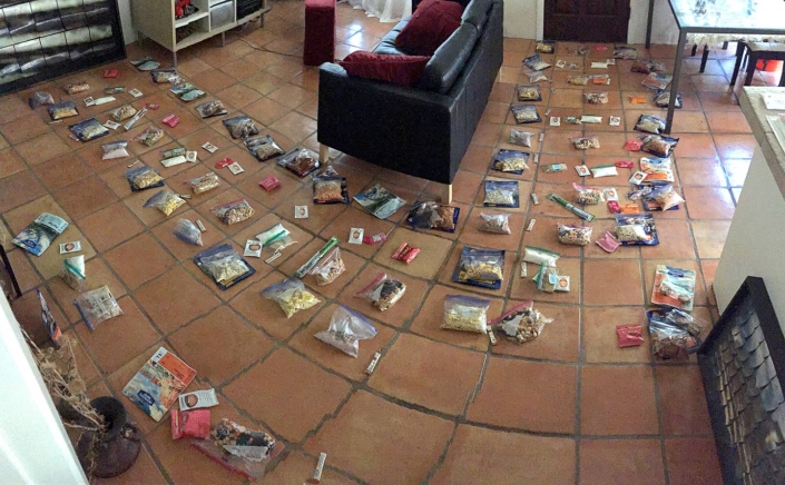
Koster uses the grid of his saltillo tile floor to help plan 23 days of meals. Each tile represents a breakfast, lunch, dinner or snacks for that day.
Logistics of the John Muir Trail
Koster: I mentioned the physical conditioning and meal planning, but coordinating the overall logistics had plenty of moving parts. Given the elevation gain and loss, a pace of 10 miles a day felt safe. Hiking at a rate of 10 miles a day for a maximum of seven days in a row- because of our food capacity- dictated our schedule. The planning came out to 3 pre-trail days and 23 days on trail. We had a total of three resupplies. A resupply did not only mean food, it was also any other essentials you might think to send yourself: batteries, toothpaste, sunblock, bandaids, medications, encouragement, cooking fuel, clothing. Granted it had to be able to fit inside a closed 5-gallon bucket that already had seven days of food in it. This was also an opportunity to offload partially used items.
The second resupply was Muir Trail Ranch and because of its remote location we had to send our resupply buckets a week before we left. Speaking of batteries, because we were hiking northbound this meant the sun was at our backs most of the time. I had a solar panel on my pack and was able to charge a small battery pack all day and then my phone at night. My phone was getting used quite a bit each day for pictures and navigation.
The Condensed JMT Schedule
- Strength & endurance conditioning
- Meal prep for 24 days
- Send request for Muir Trail Ranch to hold resupply #2, reserve two bus trips and one independent shuttle.
- One week prior to leaving home, ship two resupply buckets to Muir Trail Ranch.
- Koster drives to Lone Pine, CA to Inyo Wilderness Ranger station to complete qualification meeting with the Rangers and pick up permit. Then up to Independence, CA to drop the first two resupply buckets.
- Next day Koster drives 100+ miles north to Yosemite National Park to stash two resupply buckets in a public bear vault at Tuolumne Meadows. Leaves car in parking lot. Hitch-hikes from Yosemite National Park to the bus stop in Lee Vining, CA. Takes pre-reserved bus #1 south to Bishop, Ca., transfers to pre-reserved bus #2 down to Independence, CA and meets up with co-backpacker.
- Next day Koster & friend drive 15 miles to Onion Valley trailhead to drop co-hiker car. Rendezvous with independent shuttle. Get dropped off 25 miles south at Horseshoe Meadows.
- Spend the next day at Horseshoe Meadows acclimating to higher altitude.
- Next day begin hiking!
- Day three reach the John Muir Trail and set up camp at the base of Mt. Whitney.
- Day four ascend Mt. Whitney and officially start hiking the John Muir Trial.
- Day seven exit JMT via Kearsarge Pass to Onion Valley Trailhead. Take co-hiker’s car to resupply buckets waiting in Independence, CA.
- Day eight dive back to Onion Valley Trailhead, leave co-hiker’s car, re-enter the JMT via Kearsarge Pass.
- Day 13 reach Muir Trail Ranch and claim resupply. (two days before they close for the season)
- Day 19 reach Tuolumne Meadows and claim resupply waiting in public bear vault.
- Day 23 reach the end of JMT at Yosemite National Park. Hitch-hike back to Koster’s car at Tuolumne Meadows. Drive 100+ miles south to Onion Valley Trail head and pickup co-hikers car. Drive home!
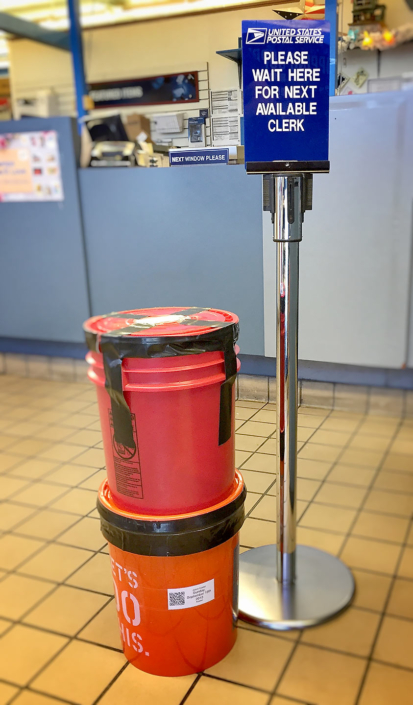
Koster & friend’s resupply buckets at the US post office being sent one week prior to leaving home to ensure on time arrival at Muir Trail Ranch.
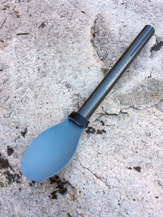
Day Zero, Koster breaks his spoon in shuttle transport to Horseshoe Meadows Campground. He uses emergency field repair splint from his tent for a makeshift spoon to use for seven days until he can get a replacement in the town of Independence. This was recorded as the worst thing to happen on the trip.
Ascending Mt. Whitney
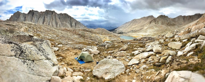
Day Three, camp at the base of Mt. Whitney facing west overlooking Guitar Lake.
Day Three, Koster, photographing at Guitar Lake.
Morning of Day Four, ascending Mt. Whitney on slick, frost-covered rocks.
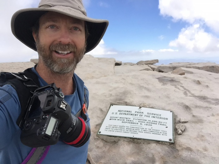
Koster at the summit of Mt. Whitney. The 1929 elevation of 14,496 was changed to 14,505 in 1988.
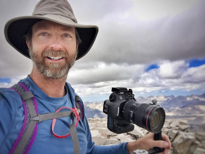
Koster photographing from the summit of Mt. Whitney.
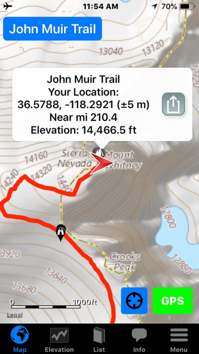
Screenshot of John Muir Trail map on Koster’s phone while descending Mt. Whitney.
Day Four, descending Mt. Whitney and heading back to Guitar Lake to break down camp and start 10-mile quota for the day.
Discovering the Panoramic Format
Months before leaving for the JMT Koster was backpacking in the Grand Canyon. He ran into what most people run into trying to photograph such an expansive sight. How do I fit this amazing place into a picture? That’s when he started experimenting with the panoramic mode on his phone. Koster loved the process and how it felt like he was capturing more of an interaction in the landscape. This led to Koster’s practice of looking over a scene he was about to photograph and asking: “Where does my picture start, and where does it stop?” A technique he brought with him on the JMT.
Koster’s Grand Canyon phone panoramic turns into inspiration for his Land Speak of the JMT series.
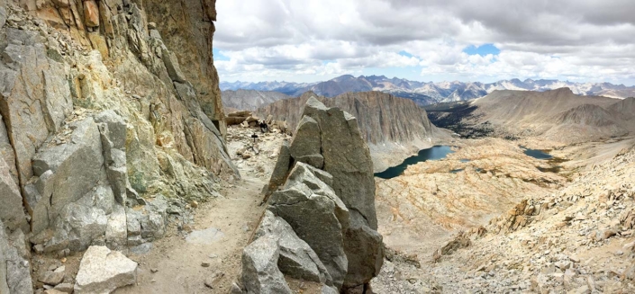
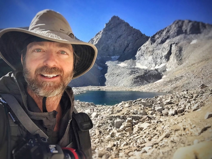
Koster on the John Muir Trail
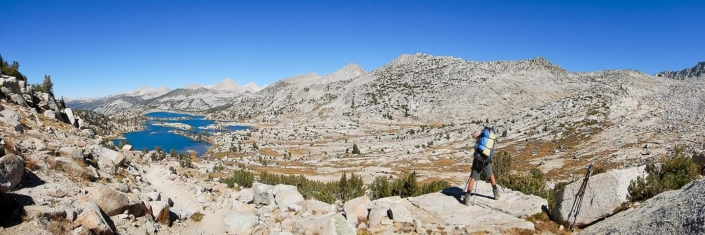
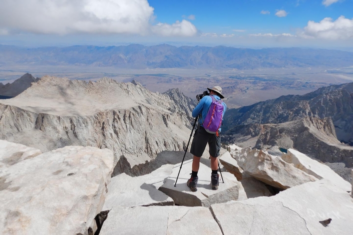
Koster photographing on the John Muir Trail.
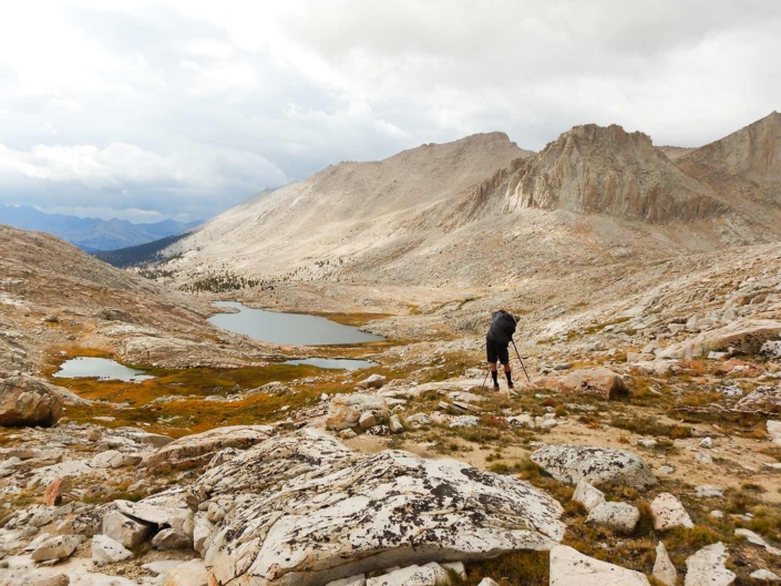
Koster photographing near Mt. Barnard on the JMT.
Koster photographing toward unknown crater on the JMT.
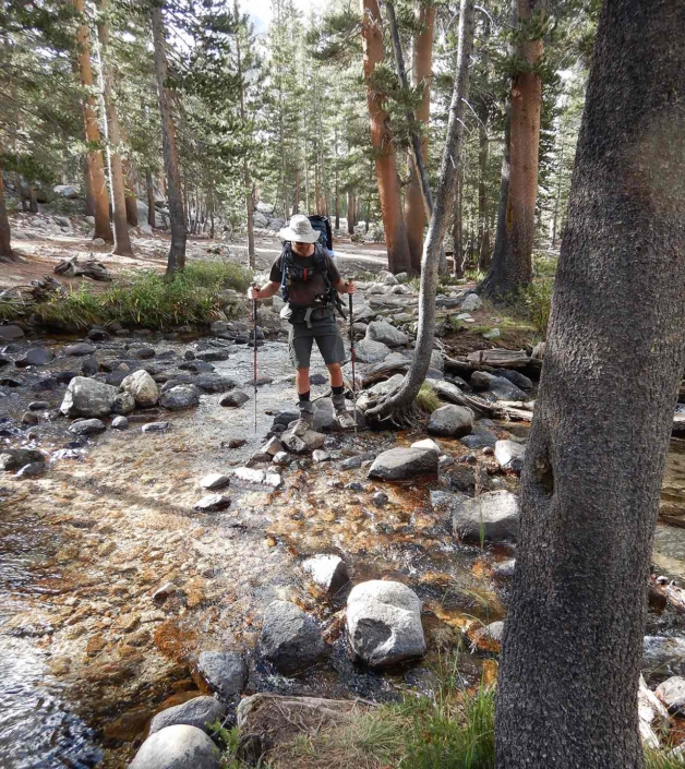
Koster crosses one of the abundant water sources of the JMT.
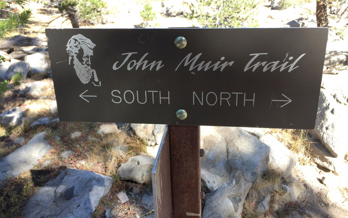
One of the many helpful signs on the JMT.
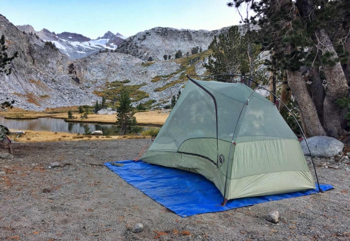
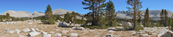
Typical camp for Koster on the JMT.
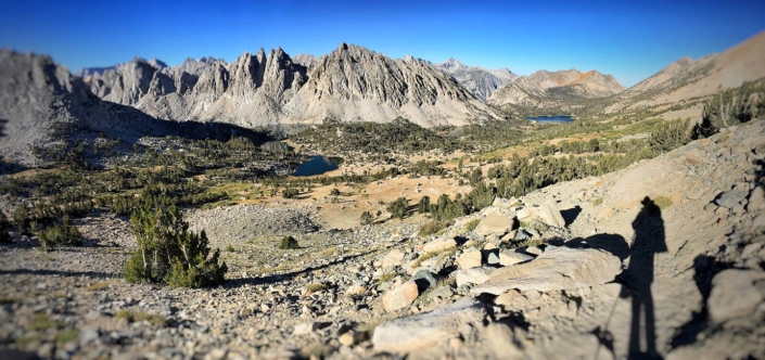
Koster’s shadow on the JMT.
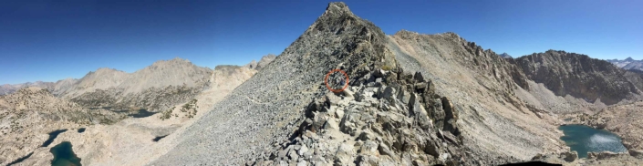
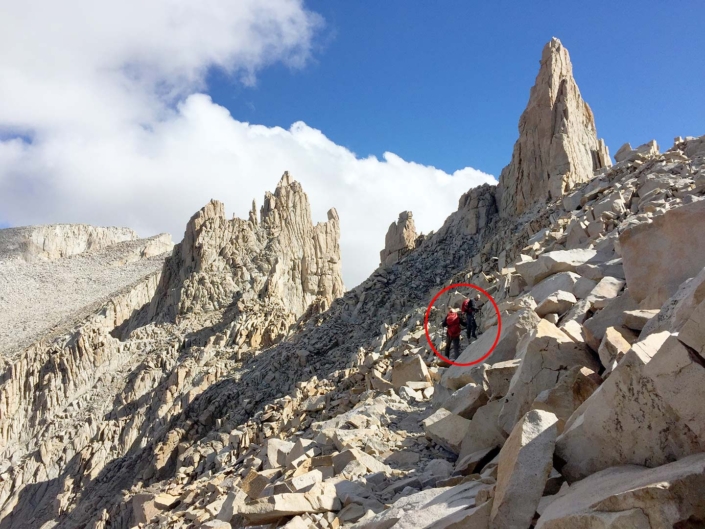
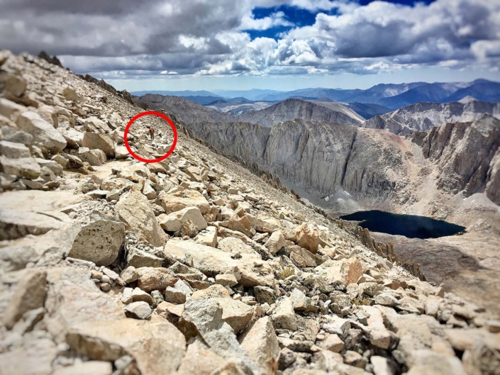
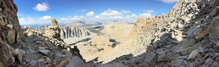
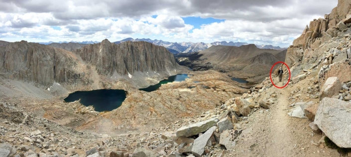
Glen Pass on the JMT with the people in the middle circled for scale.
Koster at Pyramid Lake shortly after creating image: She’s Lost Control.
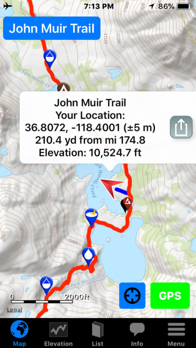
Screenshot of Koster’s phone with JMT map. Taken at the end of day at Rae Lakes. Probably while dinner was “cooking.”
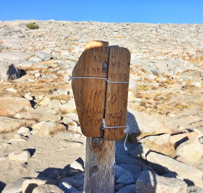
A humbling experience: after days and days of hiking and photographing, Koster reached the summit of Donahue Pass and found this sign: “Ansel Adams Wilderness.”
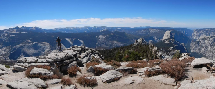
Koster and co-hiker take a slight detour to Clouds Rest to get coveted view looking down on El Capitan in Yosemite National Park.
Day 23: Koster officially completes the John Muir Trail.
Koster unfazed by 23 days and 250 miles on the John Muir Trail.
Final Thoughts
On the final morning of the journey Koster found ice in his water bottle, it was time to go home.
Starting from Horseshoe Meadows and including exits and entries via Kearsarge Pass, the entire John Muir Trail journey came to 250 miles which is a little further than hiking from New York to Boston or Los Angeles to San Diego.
This was a backpacking trip where Koster found time to take photographs. In the future, Koster would flip the priority and go photographing that required backpacking.