Erosion Stories of Paria Canyon
Behind the scenes
Introduction to Paria Canyon
Jason Koster first visited Paria Canyon in 2020 on a short trip with friends. They traversed the entire 37.5-mile stretch in three days. Koster loved the experience of navigating the slot canyons and their numerous water crossings. He knew he wanted to return and photograph the canyon at a much slower pace.
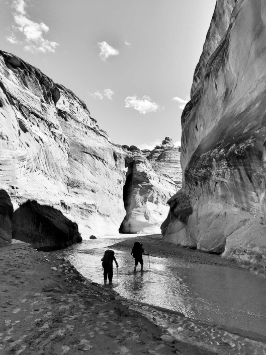
A phone image from Koster’s first trip into Paria Canyon, highlighting its many water crossings.
Koster’s friends in Paria Canyon.
Koster experienced Paria Canyon for the first time in 2020.
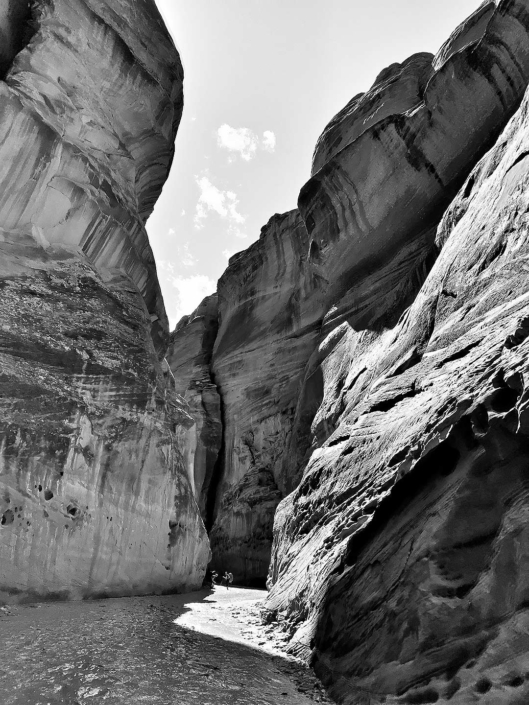
One of Koster’s panoramic phone images from 2020 that inspired his Erosion Stories of Paria Canyon series.
Getting Back to Paria Canyon
Overnight permits for Paria Canyon must be reserved four months in advance. To avoid excessive heat and the rainy season, March is considered the best time of year to visit Paria Canyon.
Koster’s first trip to Paria Canyon was in 2020. In 2021 the Ranger Station-permit office was closed. In 2022, Koster made a solo trip back to the area to start his Giants in the Gulch series in Buckskin Gulch. In 2023, just days before his second solo trip in the area, Koster received an unfortunate email from the Ranger Station informing him Paria Canyon had shoulder-deep water and swift moving currents- his trip was canceled.
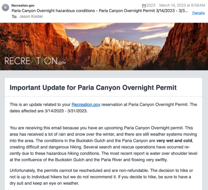
Koster received this email from the Ranger Station just a few days before departing for Paria Canyon.
Koster in Paria Canyon in 2024
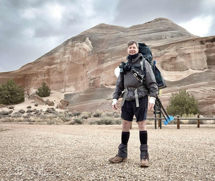
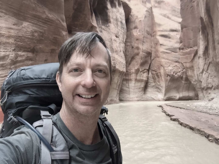
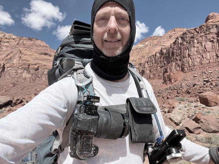
Koster, equipped with his camera, tripod, panoramic nodal head and camping gear, heads into Paria Canyon for 8 days.
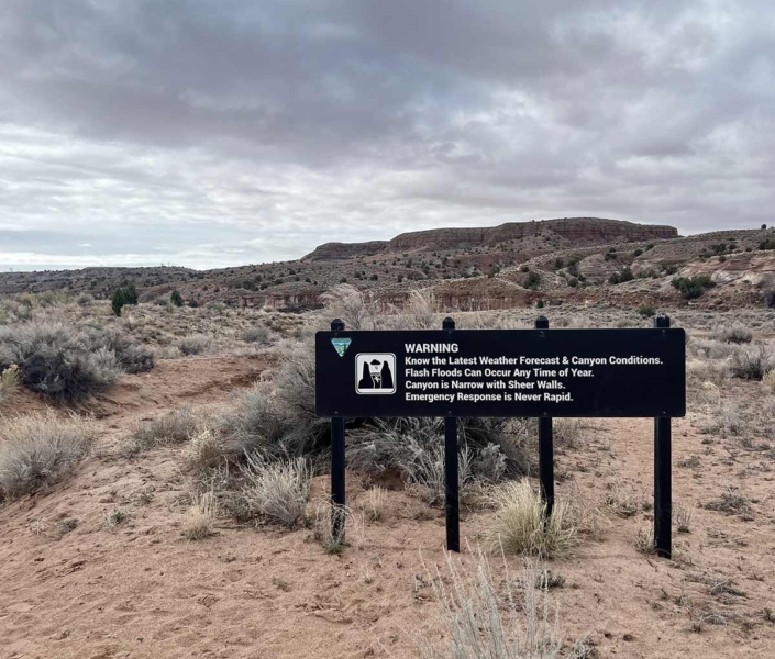
Dark clouds in the sky above the flash flood warning sign at the Whitehouse Trailhead entrance into Paria Canyon.
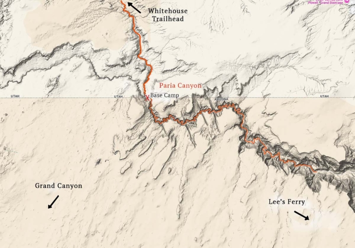
Map of Paria Canyon: It is seven miles from the White House Trailhead to Koster’s first campsite near the Arizona-Utah border.
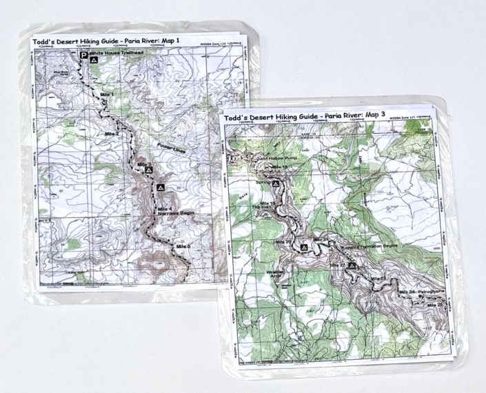
Koster’s 6×8 inch laminated maps of Paria Canyon with campsites, mileage and general locations of clear water springs.
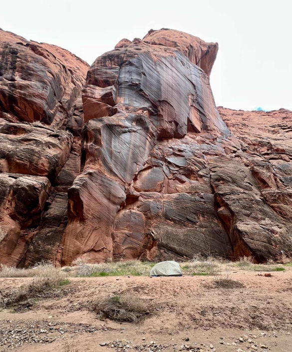
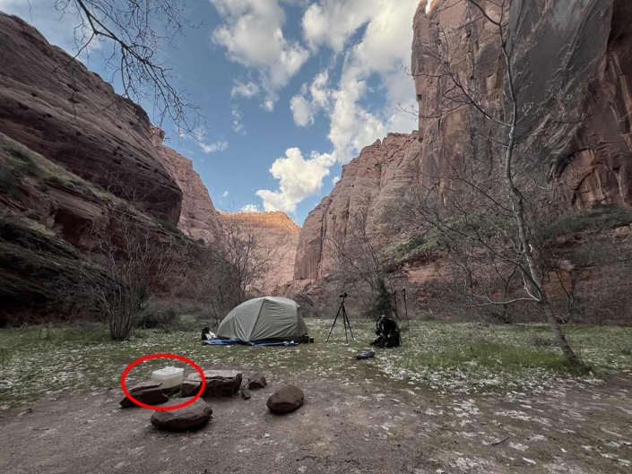
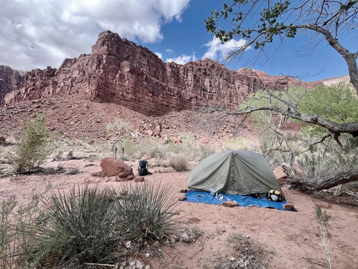
Koster’s base camp about 100 yards down river from Buckskin Gulch. The campsite is elevated just enough to minimize concern for flash floods.
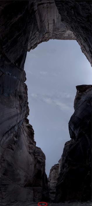
Panoramic by moonlight of Koster’s campsite. Notice Koster’s tent at the bottom of the frame. The 180˚ view extends from straight ahead to overhead and behind camera.
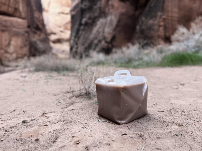
One of the first things on Koster’s agenda after reaching base camp is to collect river water. By morning the silt will have settled and the water will be clear enough to filter into drinking and cooking water.
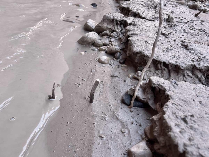
Koster’s markers at the river’s edge indicate the water level is receding.
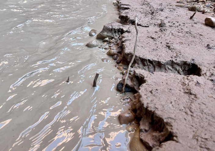
The following morning the water level was back up indicating there has been some rainfall upstream.
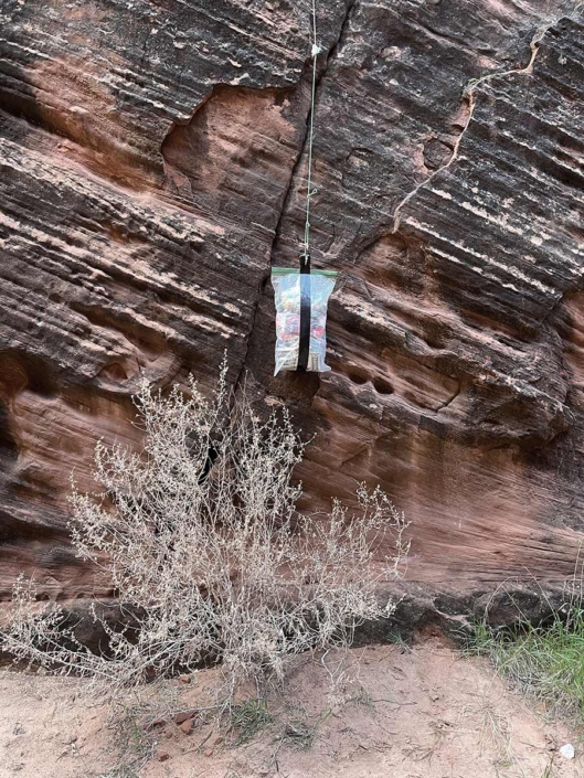
Koster hangs his food in a scentless bag from a line left by a previous camper. He hoped this would keep the rodents out of his food – but it was unsuccessful.
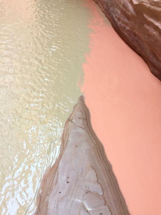
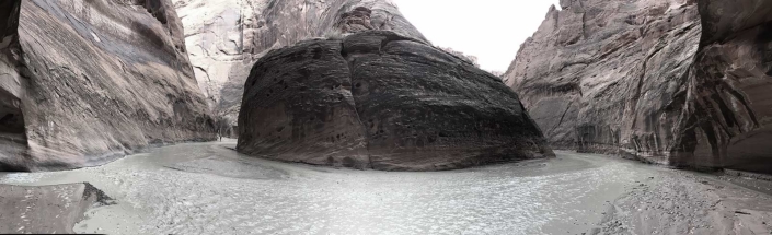
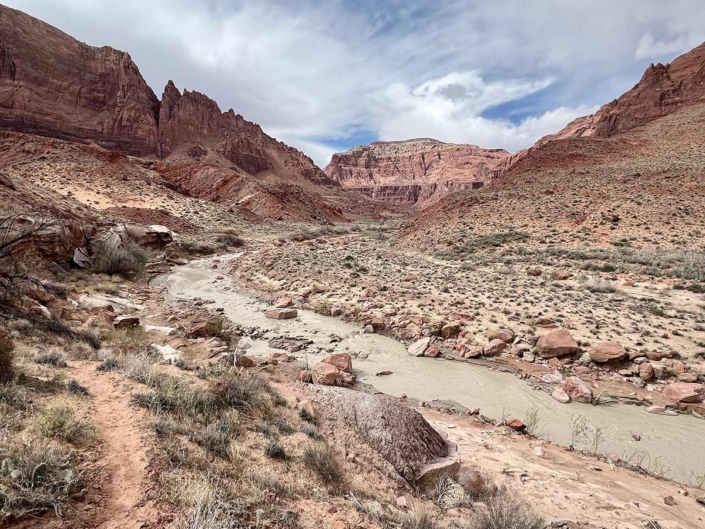
Red silty water from Buckskin Gulch joining with the green silty water of the Paria River.
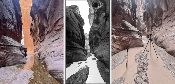
Left: Koster’s phone image taken in 2022 as a note to come back to this location.
Middle: 2024, Koster’s stitched together panoramic taken for Erosion Stories of Paria Canyon series.
Right: Koster’s phone image documenting this scene has been photographed.

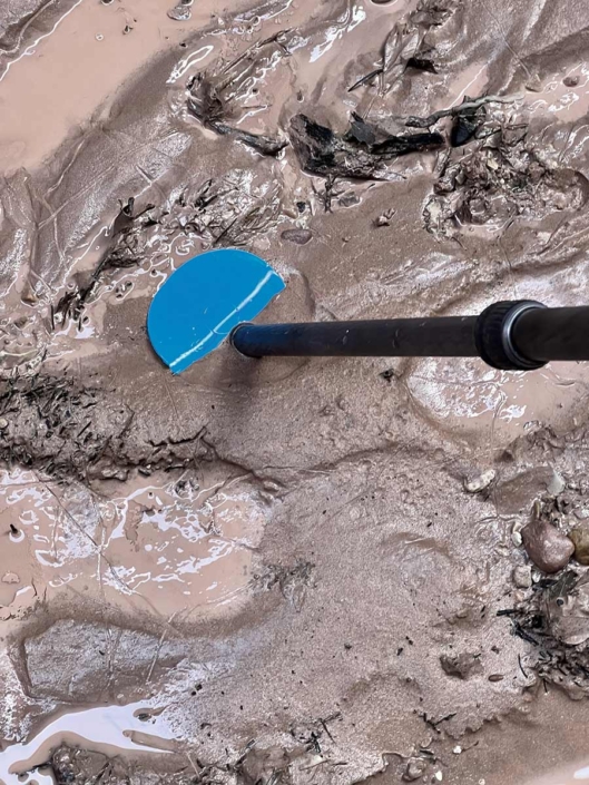
Detail from previous scene: For the Giants in the Gulch series Koster used small metal pieces as feet for his tripod. To save weight he replaced the metal with a much lighter, hard plastic. He is pleased to see it getting used on the first image of the trip.
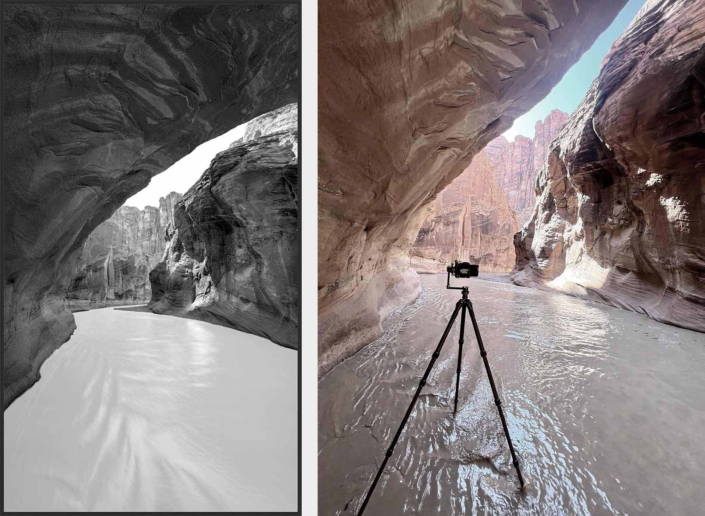
Left: A stitched together image from Koster’s Erosion Stories of Paria Canyon.
Right: Koster’s phone image documenting this scene has been photographed.
Panoramic phone image looking both up stream and down stream with Koster’s camera still in place after having completed a vertical panoramic of the scene.
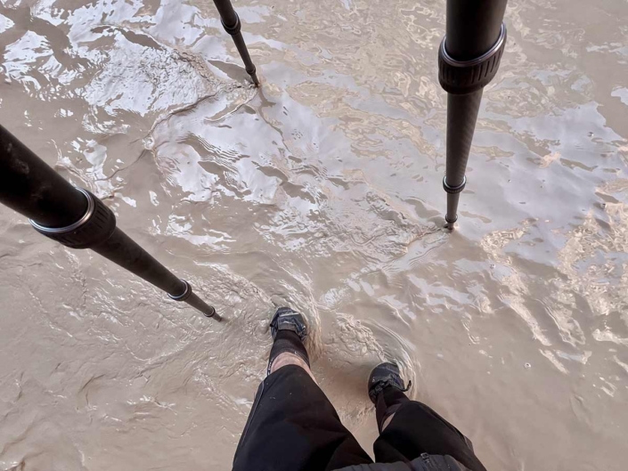
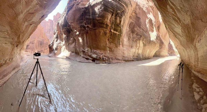
It was not uncommon for Koster and his tripod to be in the river while photographing.
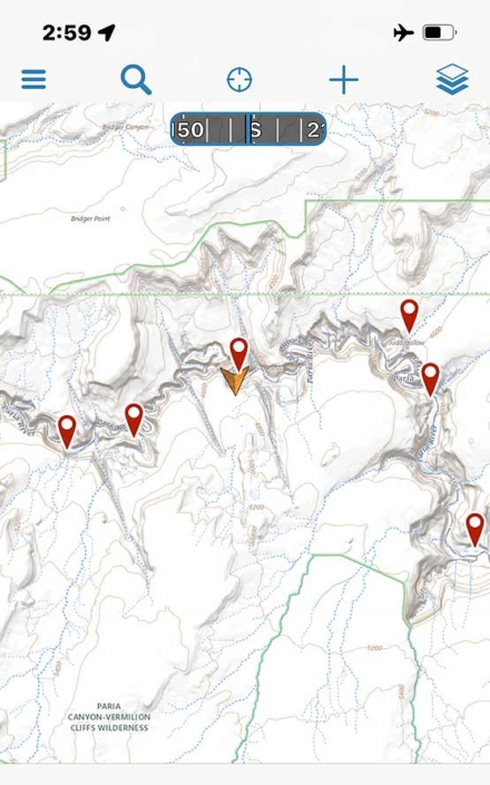
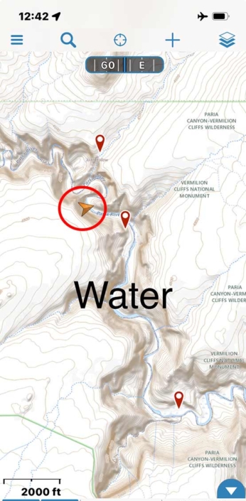
Unlike Buckskin Gulch, Paria Canyon has plenty of areas that get GPS service. This image is a screen shot of Koster’s phone with a map of Paria Canyon. When there is GPS access a gold arrow is placed on the map to show Koster’s location.
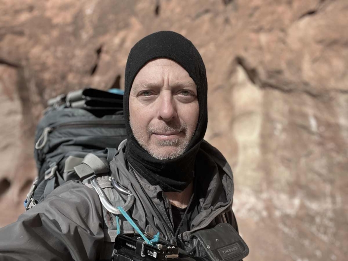
Koster wears a smart wool hood to keep the sun off his neck and the bugs out of his ears.
Koster would set up camp during the middle of the day when the light was not flattering on the canyon and then would either back track or push forward until the sun started getting too low. This image is from the later part of the day. You can see the silty river water that was collected has already separated quite a bit and will be ready for filtering in the morning.
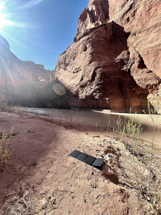
After setting up camp mid day and before going back out to photograph in the late afternoon light, Koster puts out his solar panel to charge camera batteries.
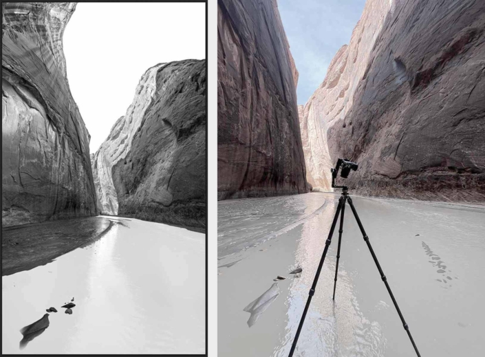
Left: Koster’s stitched together image for his Erosion Stories of Paria Canyon series.
Right: Koster’s phone image documenting this scene has been photographed.
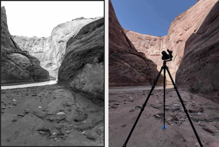
Left: Koster’s stitched together image for his Erosion Stories of Paria Canyon series.
Right: Koster’s phone image documenting this scene has been photographed.
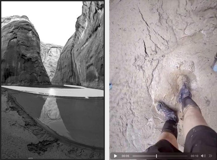
Left: Koster’s stitched together image from Erosion Stories of Paria Canyon panoramic.
Right: Video of Koster showing the quicksand around his camera. He nearly lost his right shoe while photographing. He would have to shift his weight while making camera movements, press the self timer button and then quickly step away during exposure.
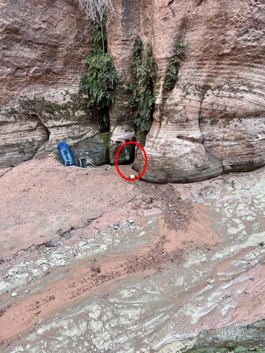
The clear water sources in Paria Canyon are not obvious. Koster would have to stay alert to clear water flowing from the south canyon walls.
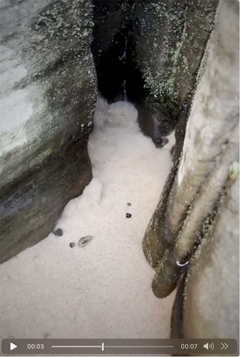
This is a clear water source. Not safe to drink straight from the source but, safe to filter or sterilize. The sand at this source was a problem at it would have clogged Koster’s water filter.
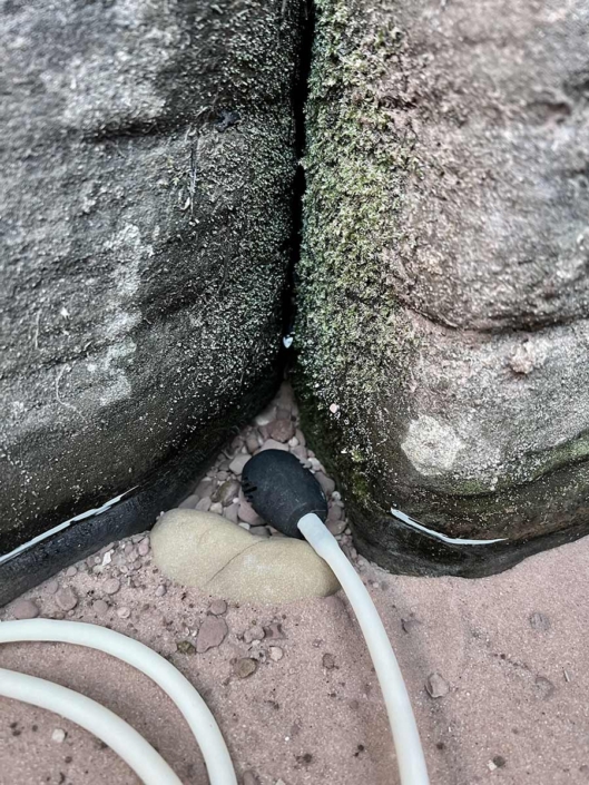
Koster places rocks at the base of the water source and then came back in the morning to filter once the sand had settled.
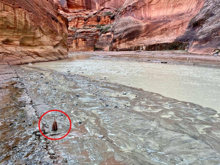
Koster checks his water mark in the morning and is relieved to see the river has gone down.
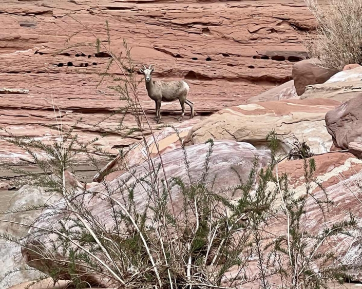
Mountain goat has a scary human sighting and then runs away.
Koster takes a screenshot of his phone to mark a new clear water source that wasn’t on his map.
Koster’s final campsite at mile 26.5 before exiting at Lee’s Ferry.
Looking upstream with moisture in the air and rain clouds approaching. Time to leave.
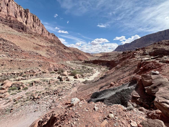
After mile 27 from the Whitehouse Trailhead the Paria Canyon opens up and is no longer a slot canyon. The last 10-miles to Lee’s Ferry look and feel quite different.
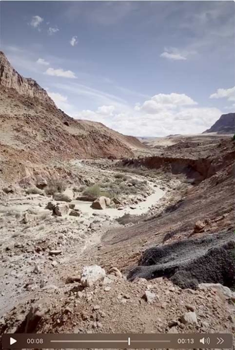
Video: A short video showing the openness of the last 10-miles of Paria Canyon.
Koster reaches Lee’s Ferry as the sun is setting on a Sunday evening. Although he had the supplies to camp the night, through the kindness of strangers he got a one hour ride all the way back to his car that was waiting at the Whitehouse Trailhead in Utah. The nice people would not accept Koster’s money but, wanted some canyon stories in exchange for the ride.
Koster on day eight makes his way the last 10-miles to exit at Lee’s Ferry.
Final Thoughts
In late March of 2025, Koster photographed the first seven miles of Paria Canyon from the Whitehouse Trailhead to the Buckskin-Paria confluence. Those files will be processed in the near future and added to the Erosion Stories of Paria Canyon gallery. Koster plans to file for a permit to photograph the final 10-miles of Paria Canyon in early December of 2025. There is little concern for flash floods in this portion of the canyon, but hopefully the summer temperatures will have cooled enough. With almost no shade in this section of the canyon, it presents a new challenge.